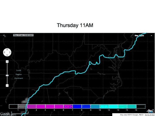
What changed from yesterday? Yesterday, the upper level component from within the southern branch of the jet stream was being stretched out into oblivion by a much larger trough from the northern branch of the jet stream. Today, the system is maintaining integrity through the Carolinas. You can see the difference between yesterday and today below. Note in the newer animation I have kept the "freezing line" at the surface. Note the newer track has the upper level component traveling farther south, thus delaying the onset of the weakening of the southern trough carrying this disturbance.
 |
| Yesterday's 500mb winds |
 |
| Today's 500mb winds (with freezing line at the surface) |
The ECMWF snow projections, with the freezing line in blue. Note that it is picking up snowfall south of the freezing line - which is accurate for the near freezing temperatures located there. South of the line, I would take 50% of the snowfall that is showing up in the model run. For other locations, the first image there is snowfall, take off 1-1.5" from the total, to account for the warm ground that must be cooled first.
 |
| ECMWF Model Snow Output |
No comments:
Post a Comment