 |
| I'll have to ask Baker Perry if there has been a Northwest Flow Snowfall event induced by a subtropical or Extra-Tropical Storm...amounts shown are grossly over-exaggerated though. |
 |
| Precipitation projections over the next several days |
 |
| Surface winds at landfall of what will be Extra-Tropical storm Sandy |
 |
| This is to show the really awesome blocking patterns in the stratosphere that are inducing this. |
 |
| First the precipitation type model through 168 hours out. Notice that with the more southerly tracking Sandy, more snow seems to appear around the High Country. Also note the significance of the snow for West Virginia. |
 |
| My vorticity run. Sometimes two lovers were just meant to be... |
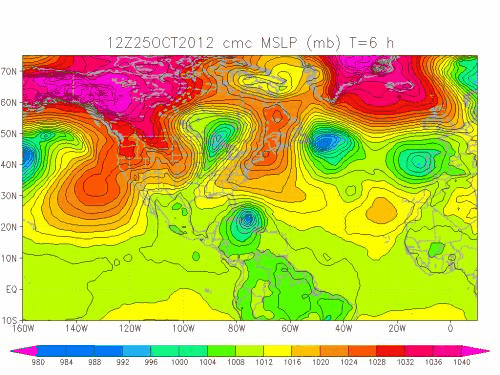 |
| The FSU model run (surface pressure). |
No comments:
Post a Comment